The Dataset Hub built for serious data buyers.

10k+ licensed datasets across 195 countries and four data pillars. Search, request, and access in a single commercial relationship. Compliance managed for you.
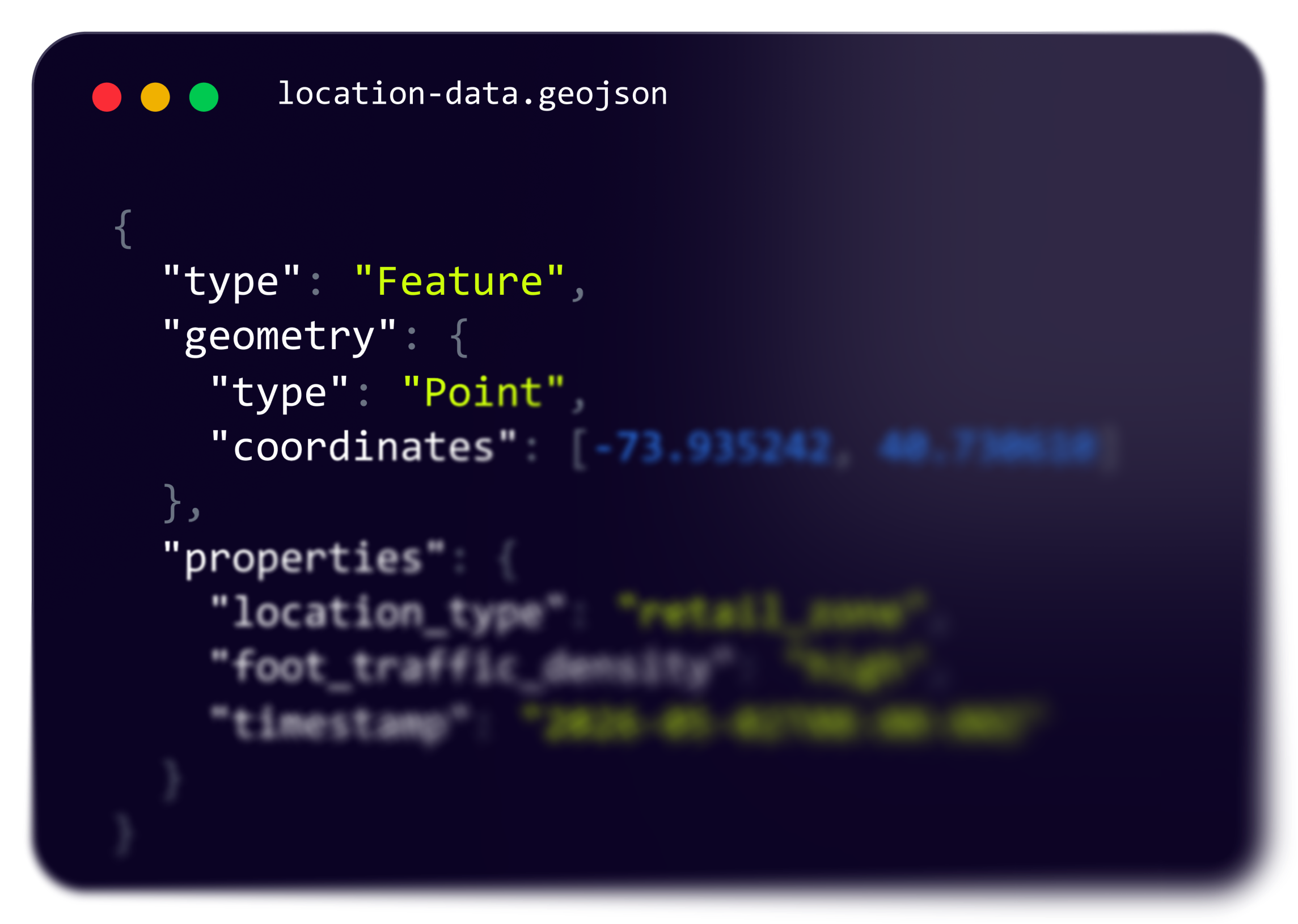
location-data.geojson
{  
     "type":  "Feature" ,  
     "geometry":    {    
              "type":   "Point" ,  
              "coordinates":  [  -73.935242 , 40.730610 ]  
       } ,  
        "properties" : {    
                 "location_type":  "retail_zone",                    "foot_traffic_density":  "high",    
                 "timestamp":   "2026-05-02T08:00:00Z"  
      }
}
UniqueID
Company Name
Trade Name
03844409205
VULGARI TRADII
MONAPPART9.COM
0475048208
LE TAMUZ A PAIR
Grenier à Pain
0541265880
FRANCY GRENIER
CLEAN-NEO
0687325009
WEST PRODUCTION
Pharmacie Lama
0778021400
VULGARI TRADII
MONAPPART9.COM
0896325855
VULGARI TRADII
MONAPPART9.COM
0885247899
VULGARI TRADII
MONAPPART9.COM
0975440920
VULGARI TRADII
MONAPPART9.COM

Find and access data in three steps

No procurement cycles. No country-by-country vendor management. One Hub, one partner.
1
Browse or search
Filter by country, dataset type or keyword. Every dataset is licensed, validated, and documented with coverage, refresh rate, and delivery format.
2
Request access
Submit a request directly from any dataset page. Our team confirms fit, scope, and terms within one business day. No long procurement forms.
3
Receive Dataset
Receive data through the delivery method you prefer: SFTP, Email, Feed/API, or S3 Bucket. Files arrive in .json, .csv, .xls, or .txt. Or access the same data through any partner platform we publish to: AWS, Snowflake, Databricks, Google Datasets, Kaggle, FactSet, or Esri. Compliance and licensing handled on our side.

Top Most Utilized Datasets

Business Firmographic Data in the United States of America

The Techsalerator Databases offer complete firmographic information on all 66,065,820 legal and active companies in the country, including revenue, number of employees, years in business, and business registration types.

KYC Identity Consumer Data in France

The Techsalerator Databases cover the KYC Identity Consumer Data on 23,468,030 consumers in France. This dataset includes the identity fields of First Name, Last name, age, phone numbers, emails as well as other individual fields on individuals in Argentina.

News Events Data in India

Techsalerator's news event data in India aggregates 8,23,592 sites and sources on a daily basis to cover the most comprehensive News Events dataset. It captures and categorizes significant events reported in various news sources, including press releases, industry news, blogs, and PR sites.

Point of Interest(POI) Data in United States

The Techsalerator Databases cover the location Data on all 66,057,289 POI's in United States. This dataset includes the Latitude and Longitude coordinates as well as other location information on each places.

Ready to find the data you need?

Browse 10,000 datasets across 195 countries. No commitment required to explore.
This is some text inside of a div block.

Satellite Imagery Data in Bahrain

Techsalerator’s Satellite Imagery Data for Bahrain provides high-resolution geospatial intelligence across the country’s ~780 sq km land area, with historical coverage spanning 10–20+ years and resolutions from ~30 cm to 30 meters. Supporting monitoring in key areas like Manama, Riffa, and Muharraq, the dataset enables infrastructure monitoring, urban planning, coastal and environmental analysis, and disaster response — with delivery available in as fast as 24 hours.
Bahrain
Geospatial
Satellite Imagery Data

Satellite Imagery Data in Bangladesh

Techsalerator’s Satellite Imagery Data for Bangladesh provides high-resolution geospatial intelligence across approximately 147,570 sq km, with historical coverage spanning 10–20+ years and resolutions from ~30 cm to 30 meters. Covering key locations like Dhaka, Chittagong, and Khulna, the dataset supports urban development analysis, agricultural monitoring, flood and disaster response, and infrastructure planning — with delivery available in as fast as 24 hours.
Bangladesh
Geospatial
Satellite Imagery Data

Satellite Imagery Data in Barbados

Techsalerator’s Satellite Imagery Data for Barbados provides high-resolution geospatial intelligence across the island’s ~430 sq km territory, with historical coverage spanning 10–20+ years and resolutions from ~30 cm to 30 meters. Supporting monitoring in key areas like Bridgetown, Speightstown, and Oistins, the dataset enables infrastructure tracking, coastal and environmental analysis, urban planning, and disaster response — with delivery available in as fast as 24 hours.
Barbados
Geospatial
Satellite Imagery Data

Satellite Imagery Data in Belarus

Techsalerator’s Satellite Imagery Data for Belarus provides high-resolution geospatial intelligence across approximately 207,600 sq km of territory, with historical coverage spanning 10–20+ years and resolutions from ~30 cm to 30 meters. Supporting monitoring in key cities like Minsk, Gomel, and Brest, the dataset enables infrastructure tracking, agricultural analysis, environmental monitoring, and disaster response — with delivery available in as fast as 24 hours.
Belarus
Geospatial
Satellite Imagery Data

Satellite Imagery Data in Belgium

Techsalerator’s Satellite Imagery Data for Belgium provides high-resolution geospatial intelligence across approximately 30,500 sq km, with historical coverage spanning 10–20+ years and resolutions from ~30 cm to 30 meters. Covering key areas such as Brussels, Antwerp, and Ghent, the dataset supports urban planning, infrastructure monitoring, agricultural analysis, environmental observation, and disaster response — with on-demand delivery available in as fast as 24 hours.
Belgium
Geospatial
Satellite Imagery Data

Satellite Imagery Data in Belize

Techsalerator’s Satellite Imagery Data for Belize delivers high-resolution geospatial intelligence across approximately 22,966 sq km, with historical coverage spanning 10–20+ years and resolutions from ~30 cm to 30 meters. Covering key areas like Belmopan, Belize City, and San Ignacio, the dataset enables infrastructure monitoring, agricultural analysis, environmental tracking, and disaster response — with delivery available in as fast as 24 hours.
Belize
Geospatial
Satellite Imagery Data

Satellite Imagery Data in Benin

Techsalerator’s Satellite Imagery Data for Benin provides high-resolution geospatial intelligence across approximately 114,763 sq km, with historical coverage spanning 10–20+ years and resolutions from ~30 cm to 30 meters. Covering key cities like Cotonou, Porto-Novo, and Parakou, the dataset enables infrastructure monitoring, agricultural analysis, urban planning, and disaster response — with delivery available in as fast as 24 hours.
Benin
Geospatial
Satellite Imagery Data

Satellite Imagery Data in Bhutan

Techsalerator’s Satellite Imagery Data for Bhutan delivers high-resolution geospatial intelligence across approximately 38,000 sq km of the country, with historical coverage spanning 10–20+ years and resolutions from ~30 cm to 30 meters. Supporting monitoring in key locations like Thimphu, Paro, and Punakha, the dataset enables infrastructure tracking, agricultural analysis, environmental monitoring, and disaster response — with delivery available in as fast as 24 hours.
Bhutan
Geospatial
Satellite Imagery Data

Satellite Imagery Data in Bolivia

Techsalerator’s Satellite Imagery Data for Bolivia delivers high-resolution geospatial intelligence across approximately 1,098,000 sq km of territory, with historical coverage spanning 10–20+ years and resolutions from ~30 cm to 30 meters. Supporting monitoring in key cities like La Paz, Santa Cruz de la Sierra, and Cochabamba, the dataset enables infrastructure tracking, agricultural analysis, environmental monitoring, and disaster response — with delivery available in as fast as 24 hours.
Bolivia
Geospatial
Satellite Imagery Data

Satellite Imagery Data in Bosnia and Herzegovina

Techsalerator’s Satellite Imagery Data for Bosnia and Herzegovina provides high-resolution geospatial intelligence across approximately 51,000 sq km, with historical coverage spanning 10–20+ years and resolutions from ~30 cm to 30 meters. Covering key areas like Sarajevo, Banja Luka, and Mostar, the dataset supports urban planning, infrastructure monitoring, agricultural analysis, border observation, and disaster response — with delivery available in as fast as 24 hours.
Bosnia and Herzegovina
Geospatial
Satellite Imagery Data

Satellite Imagery Data in Botswana

Techsalerator’s Satellite Imagery Data for Botswana provides high-resolution geospatial intelligence across approximately 581,000 sq km of the country, with historical coverage spanning 10–20+ years and resolutions from ~30 cm to 30 meters. Covering key regions like Gaborone, Francistown, and Maun, the dataset supports infrastructure monitoring, agricultural assessment, wildlife and conservation tracking, and urban planning — with delivery available in as fast as 24 hours.
Botswana
Geospatial
Satellite Imagery Data

Satellite Imagery Data in Brazil

Techsalerator’s Satellite Imagery Data for Brazil delivers high-resolution geospatial intelligence across approximately 8.5 million sq km, with historical coverage spanning 10–20+ years and resolutions from ~30 cm to 30 meters. Supporting monitoring in key cities like São Paulo, Rio de Janeiro, and Brasília, the dataset enables infrastructure tracking, agricultural analysis, deforestation and environmental monitoring, and disaster response — with delivery available in as fast as 24 hours.
Brazil
Geospatial
Satellite Imagery Data

Satellite Imagery Data in Brunei

Techsalerator’s Satellite Imagery Data for Brunei provides high-resolution geospatial intelligence covering approximately 5,765 sq km of the country, with historical imagery spanning 10–20+ years and resolutions from ~30 cm to 30 meters. Monitoring key areas like Bandar Seri Begawan and other urban and rural zones, the dataset supports infrastructure assessment, land use analysis, environmental monitoring, and disaster response — with delivery available in as fast as 24 hours.
Brunei
Geospatial
Satellite Imagery Data

Satellite Imagery Data in Bulgaria

Techsalerator’s Satellite Imagery Data for Bulgaria delivers high-resolution geospatial intelligence across approximately 110,994 sq km of the country, with historical coverage spanning 10–20+ years and resolutions from ~30 cm to 30 meters. Supporting monitoring in key cities like Sofia, Plovdiv, and Varna, the dataset enables infrastructure tracking, agricultural analysis, border monitoring, and urban planning — with delivery available in as fast as 24 hours.
Bulgaria
Geospatial
Satellite Imagery Data

Satellite Imagery Data in Burkina Faso

Techsalerator’s Satellite Imagery Data for Burkina Faso provides high-resolution geospatial intelligence across approximately 274,000 sq km, with historical coverage spanning 10–20+ years and resolutions from ~30 cm to 30 meters. Covering key regions and cities like Ouagadougou, Bobo-Dioulasso, and Koudougou, the dataset supports infrastructure monitoring, agricultural analysis, urban planning, and disaster response — with delivery available in as fast as 24 hours.
Burkina Faso
Geospatial
Satellite Imagery Data

Satellite Imagery Data in Burundi

Techsalerator’s Satellite Imagery Data for Burundi provides high-resolution geospatial intelligence across approximately 27,800 sq km of the country, with historical coverage spanning 10–20+ years and resolutions from ~30 cm to 30 meters. Covering key locations like Bujumbura, Gitega, and Ngozi, the dataset supports infrastructure monitoring, agricultural analysis, urban planning, and disaster response — with delivery available in as fast as 24 hours.
Burundi
Geospatial
Satellite Imagery Data

Satellite Imagery Data in Cambodia

Techsalerator’s Satellite Imagery Data for Cambodia delivers high-resolution geospatial intelligence across approximately 181,000 sq km of territory, with historical coverage spanning 10–20+ years and image resolutions ranging from ~30 cm to 30 meters. Supporting monitoring in key cities such as Phnom Penh, Siem Reap, and Sihanoukville, the dataset enables infrastructure tracking, agricultural monitoring, coastal and port observation, urban expansion analysis, and disaster response — with delivery available in as fast as 24 hours.
Cambodia
Geospatial
Satellite Imagery Data

Satellite Imagery Data in Cameroon

Techsalerator’s Satellite Imagery Data for Cameroon delivers high-resolution geospatial intelligence across approximately 475,000 sq km of territory, with historical coverage spanning 10–20+ years and resolutions from ~30 cm to 30 meters. Supporting monitoring in key cities like Yaoundé, Douala, and Garoua, the dataset enables infrastructure tracking, agricultural analysis, environmental monitoring, and disaster response — with delivery available in as fast as 24 hours.
Cameroon
Geospatial
Satellite Imagery Data

Satellite Imagery Data in Canada

Techsalerator’s Satellite Imagery Data for Canada delivers high-resolution geospatial intelligence across approximately 9.98 million sq km, with historical coverage spanning 10–20+ years and resolutions from ~30 cm to 30 meters. Supporting monitoring in key regions like Toronto, Vancouver, and Montreal, the dataset enables infrastructure tracking, environmental monitoring, agricultural analysis, and disaster response.
Canada
Geospatial
Satellite Imagery Data

Satellite Imagery Data in Central African Republic

Techsalerator’s Satellite Imagery Data for the Central African Republic provides high-resolution geospatial intelligence across approximately 622,000 sq km, with historical coverage spanning 10–20+ years and resolutions from ~30 cm to 30 meters. Covering key regions including Bangui, Bimbo, and Berbérati, it supports infrastructure monitoring, agricultural and environmental analysis, security observation, and disaster response.
Central African Republic
Geospatial
Satellite Imagery Data

Satellite Imagery Data in Chad

Techsalerator’s Satellite Imagery Data for Chad delivers high-resolution geospatial intelligence across approximately 1.28 million sq km of territory, with historical coverage spanning 10–20+ years and resolutions from ~30 cm to 30 meters. Supporting monitoring in key regions like N'Djamena, Moundou, and Sarh, the dataset enables infrastructure tracking, agricultural analysis, border monitoring, and disaster response.
Chad
Geospatial
Satellite Imagery Data

Satellite Imagery Data in Chile

Techsalerator’s Satellite Imagery Data for Chile provides high-resolution geospatial intelligence covering approximately 756,000 sq km of the country, with historical imagery spanning 10–20+ years and resolutions from ~30 cm to 30 meters. Key monitoring areas include Santiago, Valparaíso, and Concepción, enabling infrastructure monitoring, agricultural analysis, urban expansion tracking, and disaster response,.
Chile
Geospatial
Satellite Imagery Data

Satellite Imagery Data in China

Techsalerator’s Satellite Imagery Data for China provides high-resolution geospatial intelligence across approximately 9.6 million sq km, with historical coverage spanning 10–20+ years and resolutions from ~30 cm to 30 meters. Covering major cities like Beijing, Shanghai, and Guangzhou, the dataset enables infrastructure monitoring, agricultural and environmental analysis, urban expansion tracking, and disaster response.
China
Geospatial
Satellite Imagery Data

Satellite Imagery Data in Colombia

Techsalerator’s Satellite Imagery Data for Colombia delivers high-resolution geospatial intelligence across approximately 1,141,000 sq km of territory, with historical coverage spanning 10–20+ years and resolutions from ~30 cm to 30 meters. Supporting monitoring in key cities like Bogotá, Medellín, and Cali, the dataset enables infrastructure tracking, agricultural analysis, urban expansion monitoring, and disaster response.
Colombia
Geospatial
Satellite Imagery Data

Satellite Imagery Data in Comoros

Techsalerator’s Satellite Imagery Data for Comoros provides high-resolution geospatial intelligence across the ~2,235 sq km of the archipelago, with historical coverage spanning 10–15+ years and resolutions from ~30 cm to 30 meters. Covering key islands like Grande Comore, Mohéli, and Anjouan, the dataset supports infrastructure monitoring, environmental and agricultural analysis, coastal and disaster management, and urban planning.
Comoros
Geospatial
Satellite Imagery Data

Satellite Imagery Data in Congo (Congo-Brazzaville)

Techsalerator’s Satellite Imagery Data for Congo (Congo-Brazzaville) provides high-resolution geospatial intelligence across approximately 342,000 sq km of the country, with historical coverage spanning 10–20+ years and resolutions from ~30 cm to 30 meters. Key monitoring areas include Brazzaville, Pointe-Noire, and Dolisie, enabling infrastructure tracking, agricultural monitoring, urban expansion analysis, and disaster response.
Congo [Republic]
Geospatial
Satellite Imagery Data

Satellite Imagery Data in Costa Rica

Techsalerator’s Satellite Imagery Data for Costa Rica provides high-resolution geospatial intelligence covering approximately 51,000 sq km of the country, with historical imagery spanning 10–20+ years and resolutions from ~30 cm to 30 meters. Key monitoring areas include San José, Alajuela, and Limón, supporting infrastructure planning, agricultural analysis, environmental monitoring, and disaster response.
Costa Rica
Geospatial
Satellite Imagery Data

Satellite Imagery Data in Côte d'Ivoire

Techsalerator’s Satellite Imagery Data for Côte d’Ivoire delivers high-resolution geospatial intelligence across approximately 322,000 sq km of territory, with historical coverage spanning 10–20+ years and resolutions from ~30 cm to 30 meters. Supporting monitoring in key cities like Abidjan, Yamoussoukro, and Bouaké, the dataset enables infrastructure tracking, agricultural analysis (including cocoa-producing regions), urban expansion monitoring, and environmental assessment — with delivery available in as fast as 24 hours.
Cote d'Ivoire
Geospatial
Satellite Imagery Data

Satellite Imagery Data in Croatia

Techsalerator’s Satellite Imagery Data for Croatia provides high-resolution geospatial intelligence across approximately 56,500 sq km, with historical coverage spanning 10–20+ years and resolutions from ~30 cm to 30 meters. Supporting monitoring in key locations like Zagreb, Split, and Rijeka, the dataset enables urban planning, agricultural monitoring, infrastructure assessment, and disaster response.
Croatia
Geospatial
Satellite Imagery Data

Satellite Imagery Data in Cuba

Techsalerator’s Satellite Imagery Data for Cuba provides high-resolution geospatial intelligence across approximately 110,860 sq km of the island, with historical coverage spanning 10–20+ years and resolutions from ~30 cm to 30 meters. Supporting monitoring in key cities like Havana, Santiago de Cuba, and Camagüey, the dataset enables infrastructure tracking, agricultural analysis, urban planning, and disaster response.
Cuba
Geospatial
Satellite Imagery Data

Satellite Imagery Data in Cyprus

Techsalerator’s Satellite Imagery Data for Cyprus provides high-resolution geospatial intelligence across approximately 9,250 sq km of the island, with historical coverage spanning 10–20+ years and resolutions from ~30 cm to 30 meters. Supporting monitoring in key cities like Nicosia, Limassol, and Larnaca, the dataset enables infrastructure tracking, agricultural analysis, urban planning, and environmental monitoring.
Cyprus
Geospatial
Satellite Imagery Data

Satellite Imagery Data in Democratic Republic of the Congo

Techsalerator’s Satellite Imagery Data for the Democratic Republic of the Congo delivers high-resolution geospatial intelligence across approximately 2.34 million sq km of territory, with historical coverage spanning 10–20+ years and resolutions from ~30 cm to 30 meters. Supporting monitoring in key cities like Kinshasa, Lubumbashi, and Goma, the dataset enables infrastructure tracking, agricultural analysis, border and security monitoring, and disaster response.
Congo [DRC]
Geospatial
Satellite Imagery Data

Satellite Imagery Data in Denmark

Techsalerator’s Satellite Imagery Data for Denmark provides high-resolution geospatial intelligence covering approximately 42,900 sq km of territory, with historical coverage spanning 10–20+ years and resolutions from ~30 cm to 30 meters. Supporting monitoring in key cities like Copenhagen, Aarhus, and Odense, the dataset enables infrastructure tracking, agricultural analysis, urban planning, and environmental monitoring.
Denmark
Geospatial
Satellite Imagery Data

Satellite Imagery Data in Djibouti

Techsalerator’s Satellite Imagery Data for Djibouti delivers high-resolution geospatial intelligence across approximately 23,200 sq km of territory, with historical coverage spanning 10–20+ years and resolutions from ~30 cm to 30 meters. Supporting monitoring in key areas like Djibouti City, Ali Sabieh, and Tadjoura, the dataset enables infrastructure tracking, port and transport monitoring, urban planning, and environmental analysis.
Djibouti
Geospatial
Satellite Imagery Data

Satellite Imagery Data in Dominica

Techsalerator’s Satellite Imagery Data for Dominica provides high-resolution geospatial intelligence across the island’s ~750 sq km territory, with historical coverage spanning 10–15+ years and resolutions from ~30 cm to 10 meters. Covering key areas like Roseau and Portsmouth, the dataset supports infrastructure monitoring, agricultural analysis, disaster response, and environmental planning.
Dominica
Geospatial
Satellite Imagery Data

Satellite Imagery Data in Dominican Republic

Techsalerator’s Satellite Imagery Data for the Dominican Republic provides high-resolution geospatial intelligence covering approximately 48,400 sq km of the island, with historical imagery spanning 10–20+ years and resolutions from ~30 cm to 30 meters. Monitoring key locations such as Santo Domingo, Santiago de los Caballeros, and Punta Cana, the dataset supports infrastructure tracking, agricultural and coastal monitoring, urban planning, and disaster response.
Dominican Republic
Geospatial
Satellite Imagery Data

Satellite Imagery Data in Ecuador

Techsalerator’s Satellite Imagery Data for Ecuador delivers high-resolution geospatial intelligence across approximately 283,000 sq km, with historical coverage spanning 10–20+ years and resolutions from ~30 cm to 30 meters. Covering key areas like Quito, Guayaquil, and Cuenca, the dataset enables urban planning, agricultural monitoring, infrastructure assessment, and disaster response.
Ecuador
Geospatial
Satellite Imagery Data

Satellite Imagery Data in Egypt

Techsalerator’s Satellite Imagery Data for Egypt provides high-resolution geospatial intelligence across approximately 1,010,000 sq km, with historical coverage spanning 10–20+ years and resolutions from ~30 cm to 30 meters. Supporting monitoring in major locations like Cairo, Alexandria, and Giza, the dataset enables urban development tracking, agricultural analysis, infrastructure monitoring, and disaster response.
Egypt
Geospatial
Satellite Imagery Data

Satellite Imagery Data in El Salvador

Techsalerator’s Satellite Imagery Data for El Salvador delivers high-resolution geospatial intelligence across approximately 21,000 sq km of territory, with historical coverage spanning 10–20+ years and resolutions from ~30 cm to 30 meters. Supporting monitoring in key cities like San Salvador, Santa Ana, and San Miguel, the dataset enables infrastructure tracking, agricultural analysis, urban expansion monitoring, and disaster response.
El Salvador
Geospatial
Satellite Imagery Data

Satellite Imagery Data in Equatorial Guinea

Techsalerator’s Satellite Imagery Data for Equatorial Guinea delivers high-resolution geospatial intelligence across approximately 28,000 sq km of territory, with historical coverage spanning 10–20+ years and resolutions from ~30 cm to 30 meters. Supporting monitoring in key locations like Malabo, Bata, and Ebebiyin, the dataset enables infrastructure tracking, agricultural analysis, border observation, and disaster response.
Equatorial Guinea
Geospatial
Satellite Imagery Data

Satellite Imagery Data in Eritrea

Techsalerator’s Satellite Imagery Data for Eritrea delivers high-resolution geospatial intelligence across approximately 117,600 sq km of territory, with historical coverage spanning 10–20+ years and resolutions from ~30 cm to 30 meters. Supporting monitoring in key cities like Asmara, Keren, and Massawa, the dataset enables infrastructure tracking, agricultural analysis, border monitoring, and disaster response.
Eritrea
Geospatial
Satellite Imagery Data

Satellite Imagery Data in Estonia

Techsalerator’s Satellite Imagery Data for Estonia provides high-resolution geospatial intelligence across approximately 45,000 sq km, with historical coverage spanning 10–20+ years and resolutions from ~30 cm to 30 meters. Covering key areas like Tallinn, Tartu, and Narva, it supports urban monitoring, agricultural analysis, infrastructure assessment, and environmental management.
Estonia
Geospatial
Satellite Imagery Data

Satellite Imagery Data in Eswatini

Techsalerator’s Satellite Imagery Data for Eswatini provides high-resolution geospatial intelligence covering approximately 17,364 sq km of the country, with historical imagery spanning 10–20+ years and resolutions from ~30 cm to 30 meters. Key areas of monitoring include Mbabane, Manzini, and Lobamba, supporting infrastructure assessment, agricultural monitoring, land use planning, and disaster response.
Eswatini
Geospatial
Satellite Imagery Data

Satellite Imagery Data in Ethiopia

Techsalerator’s Satellite Imagery Data for Ethiopia delivers high-resolution geospatial intelligence across approximately 1.1 million sq km, with historical coverage spanning 10–20+ years and resolutions from ~30 cm to 30 meters. Supporting monitoring in key cities like Addis Ababa, Mekelle, and Gondar, the dataset enables infrastructure tracking, agricultural analysis, border monitoring, and disaster response.
Ethiopia
Geospatial
Satellite Imagery Data

Satellite Imagery Data in Fiji

Techsalerator’s Satellite Imagery Data for Fiji provides high-resolution geospatial intelligence across approximately 18,300 sq km of the archipelago, with historical coverage spanning 10–15+ years and resolutions from ~30 cm to 30 meters. Covering key areas like Suva, Nadi, and Lautoka, it enables monitoring of urban growth, infrastructure, agriculture, environmental changes, and disaster response.
Fiji
Geospatial
Satellite Imagery Data

Satellite Imagery Data in Finland

Techsalerator’s Satellite Imagery Data for Finland provides high-resolution geospatial intelligence covering approximately 338,000 sq km of the country, with historical imagery spanning 10–20+ years and resolutions from ~30 cm to 30 meters. Key areas of monitoring include Helsinki, Espoo, and Tampere, enabling infrastructure planning, environmental and agricultural analysis, urban growth tracking, and disaster management.
Finland
Geospatial
Satellite Imagery Data

Satellite Imagery Data in France

Techsalerator’s Satellite Imagery Data for France provides high-resolution geospatial intelligence covering approximately 643,000 sq km, with historical imagery spanning 10–20+ years and resolutions from ~30 cm to 30 meters. Key monitoring areas include Paris, Lyon, and Marseille, supporting infrastructure planning, agricultural assessment, urban expansion tracking, and disaster response.
France
Geospatial
Satellite Imagery Data

Satellite Imagery Data in Gabon

Techsalerator’s Satellite Imagery Data for Gabon provides high-resolution geospatial intelligence across approximately 267,000 sq km of territory, with historical coverage spanning 10–20+ years and resolutions from ~30 cm to 30 meters. Supporting monitoring in key cities like Libreville, Port-Gentil, and Franceville, the dataset enables infrastructure tracking, forest and agricultural analysis, environmental monitoring, and disaster response.
Gabon
Geospatial
Satellite Imagery Data

Satellite Imagery Data in Gambia

Techsalerator’s Satellite Imagery Data for Gambia delivers high-resolution geospatial intelligence across approximately 11,300 sq km of the country, with historical coverage spanning 10–20+ years and resolutions from ~30 cm to 30 meters. Supporting monitoring in key locations like Banjul, Serekunda, and Brikama, the dataset enables infrastructure tracking, agricultural analysis, flood and environmental monitoring, and urban planning.
Gambia
Geospatial
Satellite Imagery Data

Satellite Imagery Data in Georgia

Techsalerator’s Satellite Imagery Data for Georgia provides high-resolution geospatial intelligence across approximately 69,700 sq km of the country, with historical coverage spanning 10–20+ years and resolutions from ~30 cm to 30 meters. Covering key locations like Tbilisi, Batumi, and Kutaisi, it supports urban planning, infrastructure monitoring, agricultural analysis, and disaster response.
Georgia
Geospatial
Satellite Imagery Data

Satellite Imagery Data in Germany

Techsalerator’s Satellite Imagery Data for Germany provides high-resolution geospatial intelligence covering approximately 357,000 sq km, with historical imagery spanning 10–20+ years and resolutions from ~30 cm to 30 meters. Monitoring is available across major cities like Berlin, Munich, and Hamburg, enabling infrastructure tracking, agricultural analysis, urban planning, and disaster response.
Germany
Geospatial
Satellite Imagery Data

Satellite Imagery Data in Ghana

Techsalerator’s Satellite Imagery Data for Ghana provides high-resolution geospatial intelligence covering approximately 238,500 sq km, with historical imagery spanning 10–20+ years and resolutions from ~30 cm to 30 meters. Key monitoring areas include Accra, Kumasi, and Takoradi, supporting infrastructure development, agricultural analysis, urban expansion, and disaster response.
Ghana
Geospatial
Satellite Imagery Data

Satellite Imagery Data in Greece

Techsalerator’s Satellite Imagery Data for Greece delivers high-resolution geospatial intelligence across approximately 131,957 sq km, with historical coverage spanning 10–20+ years and resolutions from ~30 cm to 30 meters. Covering key locations such as Athens, Thessaloniki, and Patras, the dataset supports urban monitoring, infrastructure assessment, agricultural analysis, coastal and border observation, and disaster response.
Greece
Geospatial
Satellite Imagery Data

Satellite Imagery Data in Grenada

Techsalerator’s Satellite Imagery Data for Grenada provides high-resolution geospatial intelligence across the island’s ~344 sq km territory, with historical coverage spanning 10–15+ years and resolutions from ~30 cm to 30 meters. Supporting monitoring in key areas like St. George's, Gouyave, and Grenville, the dataset enables infrastructure tracking, agricultural and coastal monitoring, disaster response, and land use analysis.
Grenada
Geospatial
Satellite Imagery Data

Satellite Imagery Data in Guatemala

Techsalerator’s Satellite Imagery Data for Guatemala provides high-resolution geospatial intelligence across approximately 108,000 sq km, with historical coverage spanning 10–20+ years and resolutions from ~30 cm to 30 meters. Covering key locations like Guatemala City, Antigua Guatemala, and Quetzaltenango, it supports urban planning, agricultural monitoring, disaster response, and infrastructure assessment.
Guatemala
Geospatial
Satellite Imagery Data

Satellite Imagery Data in Guinea

Techsalerator’s Satellite Imagery Data for Guinea provides high-resolution geospatial intelligence across approximately 245,000 sq km of the country, with historical coverage spanning 10–20+ years and resolutions from ~30 cm to 30 meters. Covering key locations like Conakry, Nzérékoré, and Kankan, it supports infrastructure monitoring, agricultural analysis, urban planning, and disaster response.
Guinea
Geospatial
Satellite Imagery Data

Satellite Imagery Data in Guinea-Bissau

Techsalerator’s Satellite Imagery Data for Guinea-Bissau provides high-resolution geospatial intelligence across approximately 36,125 sq km, with historical coverage spanning 10–20+ years and resolutions from ~30 cm to 30 meters. Supporting monitoring in key locations like Bissau, Bafatá, and Gabú, the dataset enables infrastructure assessment, agricultural monitoring, environmental analysis, and disaster response.
Guinea-Bissau
Geospatial
Satellite Imagery Data

Satellite Imagery Data in Guyana

Techsalerator’s Satellite Imagery Data for Guyana provides high-resolution geospatial intelligence across approximately 215,000 sq km of territory, with historical coverage spanning 10–20+ years and resolutions from ~30 cm to 30 meters. Covering key regions such as Georgetown, Linden, and New Amsterdam, the dataset supports infrastructure monitoring, agricultural assessment, environmental analysis, and disaster response.
Guyana
Geospatial
Satellite Imagery Data

Satellite Imagery Data in Haiti

Techsalerator’s Satellite Imagery Data for Haiti delivers high-resolution geospatial intelligence across approximately 27,750 sq km of the country, with historical coverage spanning 10–20+ years and resolutions from ~30 cm to 30 meters. Covering key locations such as Port-au-Prince, Cap-Haïtien, and Gonaïves, the dataset enables urban development tracking, agricultural monitoring, disaster response planning, and infrastructure assessment.
Haiti
Geospatial
Satellite Imagery Data

Satellite Imagery Data in Honduras

Techsalerator’s Satellite Imagery Data for Honduras provides high-resolution geospatial intelligence across approximately 112,000 sq km, with historical coverage spanning 10–20+ years and resolutions from ~30 cm to 30 meters. Supporting monitoring in key cities like Tegucigalpa, San Pedro Sula, and La Ceiba, the dataset enables infrastructure tracking, agricultural analysis, disaster response, and environmental monitoring.
Honduras
Geospatial
Satellite Imagery Data

Satellite Imagery Data in Hungary

Techsalerator’s Satellite Imagery Data for Hungary provides high-resolution geospatial intelligence covering approximately 93,000 sq km, with historical imagery spanning 10–20+ years and resolutions from ~30 cm to 30 meters. Key monitoring areas include Budapest, Debrecen, and Szeged, enabling infrastructure assessment, agricultural monitoring, urban growth analysis, and environmental observation
Hungary
Geospatial
Satellite Imagery Data

Satellite Imagery Data in Iceland

Techsalerator’s Satellite Imagery Data for Iceland delivers high-resolution geospatial intelligence across approximately 103,000 sq km, with historical coverage spanning 10–20+ years and resolutions from ~30 cm to 30 meters. Supporting monitoring in key locations like Reykjavik, Akureyri, and Keflavik, the dataset enables volcanic and glacial monitoring, infrastructure tracking, environmental analysis, and disaster response.
Iceland
Geospatial
Satellite Imagery Data

Satellite Imagery Data in India

Techsalerator’s Satellite Imagery Data for India delivers high-resolution geospatial intelligence across approximately 3.29 million sq km, with historical coverage spanning 10–20+ years and resolutions from ~30 cm to 30 meters. Supporting monitoring in major cities like New Delhi, Mumbai, and Bengaluru, the dataset enables infrastructure tracking, agricultural analysis, urban expansion, and disaster response.
India
Geospatial
Satellite Imagery Data

Satellite Imagery Data in Indonesia

Techsalerator’s Satellite Imagery Data for Indonesia provides high-resolution geospatial intelligence across approximately 1.9 million sq km of land and islands, with historical coverage spanning 10–20+ years and resolutions from ~30 cm to 30 meters. Key monitoring areas include Jakarta, Surabaya, and Medan, supporting urban growth analysis, infrastructure tracking, agricultural monitoring, disaster response, and environmental planning.
Indonesia
Geospatial
Satellite Imagery Data

Satellite Imagery Data in Iran

Techsalerator’s Satellite Imagery Data for Iran delivers high‑resolution geospatial intelligence across the country’s ~1.65 million km² landmass, with historical imagery spanning 10–20+ years and spatial resolutions from ~30 cm to 30 m. The dataset supports monitoring in major urban and strategic regions such as Tehran, Mashhad, Isfahan, Karaj, and Shiraz, enabling infrastructure tracking, agricultural analysis, border and security monitoring, and disaster response.
Iran
Geospatial
Satellite Imagery Data

Satellite Imagery Data in Iraq

Techsalerator’s Satellite Imagery Data for Iraq delivers high-resolution geospatial intelligence across approximately 438,000 sq km of territory, with historical imagery coverage spanning 10–20+ years and resolutions ranging from ~30 cm to 30 meters. Supporting monitoring in key cities such as Baghdad, Basra, and Erbil, the dataset enables infrastructure monitoring, oil and energy site analysis, agricultural assessment, border surveillance, and disaster response.
Iraq
Geospatial
Satellite Imagery Data

Satellite Imagery Data in Ireland

Techsalerator’s Satellite Imagery Data for Ireland delivers high-resolution geospatial intelligence across approximately 70,300 sq km of territory, with historical imagery coverage spanning 10–20+ years and resolutions ranging from ~30 cm to 30 meters. Supporting monitoring in key cities such as Dublin, Cork, and Galway, the dataset enables infrastructure monitoring, agricultural assessment, coastal analysis, urban expansion tracking, and environmental management.
Ireland
Geospatial
Satellite Imagery Data

Satellite Imagery Data in Israel

Techsalerator’s Satellite Imagery Data for Israel delivers high-resolution geospatial intelligence across approximately 22,000 sq km of territory, with historical coverage spanning 10–20+ years and resolutions ranging from ~30 cm to 30 meters. Supporting monitoring in key cities such as Jerusalem, Tel Aviv, and Haifa, the dataset enables infrastructure monitoring, agricultural analysis, border observation, coastal assessment, and disaster response.
Ireland
Geospatial
Satellite Imagery Data

Satellite Imagery Data in Italy

Techsalerator’s Satellite Imagery Data for Italy provides high-resolution geospatial intelligence across approximately 301,000 sq km, with historical coverage spanning 10–20+ years and resolutions from ~30 cm to 30 meters. Covering major regions and cities like Rome, Milan, and Naples, the dataset supports infrastructure monitoring, urban growth analysis, agricultural assessment, and disaster response.
Italy
Geospatial
Satellite Imagery Data

Satellite Imagery Data in Jamaica

Techsalerator’s Satellite Imagery Data for Jamaica provides high-resolution geospatial intelligence across approximately 10,900 sq km of the island, with historical coverage spanning 10–20+ years and resolutions from ~30 cm to 30 meters. Supporting monitoring in key areas like Kingston, Montego Bay, and Mandeville, the dataset enables infrastructure tracking, agricultural analysis, coastal and disaster monitoring, and urban planning.
Jamaica
Geospatial
Satellite Imagery Data

Satellite Imagery Data in Japan

Techsalerator’s Satellite Imagery Data for Japan delivers high-resolution geospatial intelligence across approximately 377,975 sq km of the country, with historical coverage spanning 10–20+ years and resolutions from ~30 cm to 30 meters. Supporting monitoring in key cities like Tokyo, Osaka, and Nagoya, the dataset enables infrastructure tracking, urban expansion analysis, disaster response, and agricultural monitoring
Japan
Geospatial
Satellite Imagery Data

Satellite Imagery Data in Jordan

Techsalerator’s Satellite Imagery Data for Jordan provides high-resolution geospatial intelligence across approximately 89,000 sq km, with historical coverage spanning 10–20+ years and resolutions from ~30 cm to 30 meters. Covering key locations like Amman, Aqaba, and Irbid, the dataset enables urban planning, infrastructure monitoring, agricultural assessment, and disaster response.
Jordan
Geospatial
Satellite Imagery Data

Satellite Imagery Data in Kazakhstan

Techsalerator’s Satellite Imagery Data for Kazakhstan provides high-resolution geospatial intelligence covering approximately 2.7 million sq km of territory, with historical imagery spanning 10–20+ years and resolutions from ~30 cm to 30 meters. Key locations monitored include Almaty, Nur-Sultan, and Shymkent, supporting infrastructure tracking, agricultural monitoring, border observation, and disaster response.
Kazakhstan
Geospatial
Satellite Imagery Data

Satellite Imagery Data in Kenya

Techsalerator’s Satellite Imagery Data for Kenya provides high-resolution geospatial intelligence across approximately 580,000 sq km, with historical coverage spanning 10–20+ years and resolutions from ~30 cm to 30 meters. Covering key locations like Nairobi, Mombasa, and Kisumu, the dataset supports infrastructure monitoring, agricultural analysis, urban planning, and disaster response.
Kenya
Geospatial
Satellite Imagery Data

Satellite Imagery Data in Kiribati

Techsalerator’s Satellite Imagery Data for Kiribati delivers high-resolution geospatial intelligence across the nation’s ~811 sq km of dispersed atolls and islands, with historical coverage spanning 10–20+ years and resolutions from ~30 cm to 30 meters. Supporting monitoring in key locations like South Tarawa, Kiritimati, and Betio, the dataset enables coastal change detection, infrastructure monitoring, environmental assessment, and disaster response
Kiribati
Geospatial
Satellite Imagery Data

Satellite Imagery Data in Kuwait

Techsalerator’s Satellite Imagery Data for Kuwait provides high-resolution geospatial intelligence across the country’s ~17,800 sq km territory, with historical coverage of 10–20+ years and resolutions from ~30 cm to 30 meters. Covering key areas like Kuwait City, Al Ahmadi, and Hawally, the dataset supports urban planning, infrastructure monitoring, environmental analysis, and emergency response.
Kuwait
Geospatial
Satellite Imagery Data

Satellite Imagery Data in Kyrgyzstan

Techsalerator’s Satellite Imagery Data for Kyrgyzstan provides high-resolution geospatial intelligence across approximately 199,900 sq km of the country, with historical coverage spanning 10–20+ years and resolutions from ~30 cm to 30 meters. Key monitoring areas include Bishkek, Osh, and Jalal-Abad, supporting infrastructure tracking, agricultural analysis, border observation, and disaster response.
Kyrgyzstan
Geospatial
Satellite Imagery Data

Satellite Imagery Data in Laos

Techsalerator’s Satellite Imagery Data for Laos provides high-resolution geospatial intelligence across approximately 236,800 sq km of the country, with historical coverage spanning 10–20+ years and resolutions from ~30 cm to 30 meters. Covering key areas like Vientiane, Luang Prabang, and Savannakhet, the dataset supports infrastructure monitoring, agricultural analysis, border and river management, and disaster response.
Laos
Geospatial
Satellite Imagery Data

Satellite Imagery Data in Latvia

Techsalerator’s Satellite Imagery Data for Latvia provides high-resolution geospatial intelligence covering approximately 64,600 sq km, with historical imagery spanning 10–20+ years and resolutions from ~30 cm to 30 meters. Key monitoring areas include Riga, Daugavpils, and Liepaja, supporting urban planning, infrastructure assessment, agricultural monitoring, and environmental analysis.
Latvia
Geospatial
Satellite Imagery Data

Satellite Imagery Data in Lebanon

Techsalerator’s Satellite Imagery Data for Lebanon provides high-resolution geospatial intelligence across approximately 10,400 sq km, with historical coverage spanning 10–20+ years and resolutions from ~30 cm to 30 meters. Covering key locations like Beirut, Tripoli, and Sidon, the dataset supports infrastructure monitoring, urban expansion analysis, agricultural tracking, and disaster response.
Lebanon
Geospatial
Satellite Imagery Data

Satellite Imagery Data in Lesotho

Techsalerator’s Satellite Imagery Data for Lesotho provides high-resolution geospatial intelligence covering approximately 30,000 sq km of the country, with historical imagery dating back 10–15+ years and resolutions from ~50 cm to 30 meters. Monitoring key areas such as Maseru, Teyateyaneng, and Butha-Buthe, the dataset supports infrastructure tracking, agricultural analysis, environmental monitoring, and disaster response.
Lesotho
Geospatial
Satellite Imagery Data

Satellite Imagery Data in Liberia

Techsalerator’s Satellite Imagery Data for Liberia delivers high-resolution geospatial intelligence across approximately 111,000 sq km of territory, with historical coverage spanning 10–20+ years and resolutions from ~30 cm to 30 meters. Supporting monitoring in key cities like Monrovia, Gbarnga, and Buchanan, the dataset enables infrastructure tracking, agricultural analysis, urban planning, and disaster response.
Liberia
Geospatial
Satellite Imagery Data

Satellite Imagery Data in Libya

Techsalerator’s Satellite Imagery Data for Libya provides high-resolution geospatial intelligence covering approximately 1.76 million sq km of the country, with historical imagery spanning 10–20+ years and resolutions from ~30 cm to 30 meters. Focused monitoring in major cities like Tripoli, Benghazi, and Misrata supports infrastructure assessment, agricultural analysis, border and security observation, and disaster response.
Libya
Geospatial
Satellite Imagery Data

Satellite Imagery Data in Liechtenstein

Techsalerator’s Satellite Imagery Data for Liechtenstein provides high-resolution geospatial intelligence across the country’s ~160 sq km territory, with historical coverage spanning 10–20+ years and resolutions from ~30 cm to 30 meters. Covering key areas like Vaduz, Schaan, and Triesen, the dataset supports infrastructure monitoring, land use analysis, environmental assessment, and urban planning.
Liechtenstein
Geospatial
Satellite Imagery Data

Satellite Imagery Data in Lithuania

Techsalerator’s Satellite Imagery Data for Lithuania provides high-resolution geospatial intelligence across approximately 65,300 sq km, with historical coverage spanning 10–20+ years and resolutions from ~30 cm to 30 meters. Supporting monitoring in key cities like Vilnius, Kaunas, and Klaipėda, the dataset enables infrastructure tracking, agricultural analysis, urban planning, and environmental monitoring.
Lithuania
Geospatial
Satellite Imagery Data

Satellite Imagery Data in Luxembourg

Techsalerator’s Satellite Imagery Data for Luxembourg provides high-resolution geospatial intelligence across the country’s ~2,586 sq km territory, with historical coverage spanning 10–20+ years and resolutions from ~30 cm to 30 meters. Covering key areas like Luxembourg City, Esch-sur-Alzette, and Differdange, the dataset supports urban planning, infrastructure monitoring, environmental analysis, and disaster response.
Luxembourg
Geospatial
Satellite Imagery Data

Satellite Imagery Data in Madagascar

echsalerator’s Satellite Imagery Data for Madagascar delivers high-resolution geospatial intelligence across approximately 587,000 sq km of land area, with historical imagery coverage spanning 10–20+ years and resolutions ranging from ~30 cm to 30 meters. Supporting monitoring in key locations such as Antananarivo, Toamasina, and Mahajanga, the dataset enables environmental monitoring, agricultural analysis, infrastructure tracking, and disaster response.
Madagascar
Geospatial
Satellite Imagery Data

Satellite Imagery Data in Malawi

Techsalerator’s Satellite Imagery Data for Malawi delivers high-resolution geospatial intelligence across approximately 118,000 sq km of territory, with historical coverage spanning 10–20+ years and image resolutions ranging from ~30 cm to 30 meters. Supporting monitoring in key areas such as Lilongwe, Blantyre, and Mzuzu, the dataset enables infrastructure monitoring, agricultural analysis, disaster response, and land-use planning.
Malawi
Geospatial
Satellite Imagery Data

Satellite Imagery Data in Malaysia

Techsalerator’s Satellite Imagery Data for Malaysia provides high-resolution geospatial intelligence covering approximately 330,000 sq km across both Peninsular and East Malaysia. With historical imagery spanning 10–20+ years and resolutions ranging from ~30 cm to 30 meters, users can monitor infrastructure, agriculture, forests, and coastal regions. The dataset supports analysis in key cities such as Kuala Lumpur, Johor Bahru, George Town, and Kota Kinabalu, enabling urban expansion tracking, environmental monitoring, and disaster response.
Malaysia
Geospatial
Satellite Imagery Data

Satellite Imagery Data in Maldives

Techsalerator’s Satellite Imagery Data for Maldives delivers high-resolution geospatial intelligence across approximately 300 sq km of land area and 90,000+ sq km of surrounding maritime territory, with historical imagery coverage spanning 10–20+ years and resolutions ranging from ~30 cm to 30 meters. Supporting monitoring in key areas such as Malé, Addu City, and Fuvahmulah, the dataset enables coastal monitoring, urban development analysis, environmental protection, and disaster response.
Maldives
Geospatial
Satellite Imagery Data

Satellite Imagery Data in Mali

Techsalerator’s Satellite Imagery Data for Mali provides high-resolution geospatial intelligence covering approximately 1,240,000 sq km of the country, with historical imagery spanning 10–20+ years and resolutions from ~30 cm to 30 meters. It supports monitoring in key regions and cities like Bamako, Sikasso, and Timbuktu, enabling infrastructure assessment, agricultural analysis, border surveillance, and disaster response.
Mali
Geospatial
Satellite Imagery Data

Satellite Imagery Data in Malta

Techsalerator’s Satellite Imagery Data for Malta provides high-resolution geospatial intelligence across the entire country, covering approximately 316 sq km, with historical imagery spanning 10–20+ years and resolutions from ~30 cm to 30 meters. Monitoring key areas like Valletta, Mdina, and Sliema, the dataset supports urban planning, infrastructure assessment, coastal and agricultural monitoring, and disaster response.
Malta
Geospatial
Satellite Imagery Data

Satellite Imagery Data in Marshall Islands

Techsalerator’s Satellite Imagery Data for the Marshall Islands provides high-resolution geospatial intelligence across approximately 181 sq km of atolls and islands, with historical coverage spanning 10–15+ years and resolutions from ~30 cm to 30 meters. Supporting monitoring in key locations like Majuro, Ebeye, and Jaluit, the dataset enables infrastructure tracking, coastal and environmental monitoring, disaster response, and urban planning.
Marshall Islands
Geospatial
Satellite Imagery Data

Satellite Imagery Data in Mauritania

Techsalerator’s Satellite Imagery Data for Mauritania provides high-resolution geospatial intelligence across approximately 1,030,700 sq km of territory, with historical coverage spanning 10–20+ years and resolutions from ~30 cm to 30 meters. Covering key regions and cities like Nouakchott, Nouadhibou, and Kiffa, the dataset enables infrastructure monitoring, agricultural analysis, urban planning, and environmental tracking.
Mauritania
Geospatial
Satellite Imagery Data

Satellite Imagery Data in Mauritius

Techsalerator’s Satellite Imagery Data for Mauritius provides high-resolution geospatial intelligence across the island’s ~2,040 sq km, with historical imagery spanning 10–20+ years and resolutions from ~30 cm to 30 meters. Covering key areas like Port Louis, Curepipe, and Quatre Bornes, the dataset supports infrastructure monitoring, coastal and environmental analysis, urban planning, and disaster management.
Mauritius
Geospatial
Satellite Imagery Data

Satellite Imagery Data in Mexico

Techsalerator’s Satellite Imagery Data for Mexico provides high-resolution geospatial intelligence across approximately 1,964,000 sq km, with historical coverage spanning 10–20+ years and resolutions from ~30 cm to 30 meters. Covering major cities like Mexico City, Guadalajara, and Monterrey, the dataset supports urban planning, agricultural monitoring, border and infrastructure tracking, and disaster response.
Mexico
Geospatial
Satellite Imagery Data

Satellite Imagery Data in Micronesia

Techsalerator’s Satellite Imagery Data for Micronesia provides high-resolution geospatial intelligence across the country’s ~702 islands and ~702 km² of land area, with historical coverage spanning 10–20+ years and resolutions from ~30 cm to 30 meters. Covering key regions such as Palikir, Kolonia, and Weno, this dataset supports infrastructure monitoring, coastal and agricultural analysis, disaster response, and environmental observation.
Micronesia
Geospatial
Satellite Imagery Data

Satellite Imagery Data in Moldova

Techsalerator’s Satellite Imagery Data for Moldova provides high-resolution geospatial intelligence across approximately 33,800 sq km, with historical coverage spanning 10–20+ years and resolutions from ~30 cm to 30 meters. Covering key areas like Chișinău, Tiraspol, and Bălți, the dataset supports infrastructure monitoring, agricultural assessment, urban planning, and environmental analysis.
Moldova
Geospatial
Satellite Imagery Data

Satellite Imagery Data in Monaco

Techsalerator’s Satellite Imagery Data for Monaco delivers high-resolution geospatial intelligence across the country’s ~2.02 sq km territory, with historical coverage spanning 10–20+ years and resolutions from ~30 cm to 10 meters. Covering key areas such as Monaco-Ville, Monte Carlo, and La Condamine, the dataset supports urban planning, infrastructure monitoring, coastal analysis, and event management.
Monaco
Geospatial
Satellite Imagery Data

Satellite Imagery Data in Mongolia

Techsalerator’s Satellite Imagery Data for Mongolia provides high-resolution geospatial intelligence across approximately 1.56 million sq km, with historical coverage spanning 10–20+ years and resolutions from ~30 cm to 30 meters. Covering key locations like Ulaanbaatar, Erdenet, and Darkhan, the dataset supports infrastructure monitoring, mining and agricultural analysis, border observation, and disaster response
Mongolia
Geospatial
Satellite Imagery Data
Error image
No results found.
Thank you! Your submission has been received!
Oops! Something went wrong while submitting the form.

Ready to find the data you need?

Browse 10k+ datasets across 195 countries. No commitment required to explore.